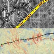
We are excited to launch this newest project which combines wildlife observations with connectivity models to more accurately represent potential wildlife movement in California. Using our extensive dataset of wildlife observations, consensus rule-development, and advanced modeling techniques in ArcGIS and R, we propose to develop localized and statewide connectivity maps for individual species and for whole groups. Unlike previous modeling efforts in California, these will be based on and enhanced by actual wildlife occurrences. Join us in this exciting adventure.
Project Status
Completed Project
Program

