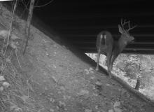
During the first phase of this project (2011-2012) we set up photo-monitoring and track stations at over a dozen structures where animals could pass safely under or over Interstate 80 in the Sierra Nevada foothills. Because of the topographical positioning of I-80, there are very few places where animals can safely pass through or over large structures with habitat on either side of the right-of-way. This means each of the infrequent structures could be very important to the wildlife in a particular plant community and/or elevational zone. Track stations were deployed for 6 months at each of the street over-crossings within the foothill portion of I-80. Cameras were deployed at a dozen under-crossing structures for part or all of two years and every animal passing through the structures identified. A draft report is available that includes information about the project.
During Phase II, graduate student Kate Tiedemann, undergraduate student assistants and staff will maintain camera traps and monitor roadkilled animals and compare these findings to "connectivity maps" to see if connectivity modeling can explain animal movement.
(This project was originally funded by the UC Davis Sustainable Transportation Center and is now supported in part by the Federal Highways Administration)

