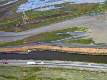
Climate change has already been accompanied by sea level rise, up to 8” in the Bay Area in the last century. Sea level is predicted to rise by over 55 inches (1.5 meters) by 2100 and storm-induced wave action is predicted to intensify, even if currently-feasible carbon mitigation is implemented at a global scale. Transportation infrastructure and essential marshlands are at risk of inundation from sea level rise, storms, and tidal deterioration. Disruption of the Bay Area’s transportation network will put at risk billions of dollars/year in economic activity. The Study will inform the Department’s long-range planning effort for State Route (SR) 37 by providing crucial information on the expected shorter- and long-term impacts of SLR on the facility and by developing high-level cost estimates for adaptive road/structure designs to help decision-making on the future of the facility.
There are two primary goals for the project:
1. Maintain/improve transportation corridor benefits (mobility and safety, environment, and public access to surrounding areas) and develop long-term solutions for the corridor.
2. Determine how to support large-scale restoration of tidal and other marshes to benefit native species, ecological processes, and decrease the severity of storms and tidal action coastal infrastructure.
In Phase I of this project (funded by the National Academy of Sciences, Transportation Research Board), a stakeholder process was initiated and infomation was collected describing the natural and human context of the corridor. 5 scenarios were considered for the highway and summaries of this consideration and other information included a report available on the project website.
In Phase II of the project (funded by Caltrans Planning and Research), the stakeholder process was continued and a greater emphasis placed on the effect of sea level rise on the highway, surrounding berms and levees, and adjacent marshes. The number of scenarios was reduced to 1) the roadway on a raised levee and 2) the roadway on a causeway above the marshes or Bay. Information about this phase is also available on the project website.

